post

Roundhouse (Field Trip: Litter Shrine)

Christ Church, the original building that became the Roundhouse, closed in 1880.

Manchester Settlement: a registered charity founded in 1895 by the University of Manchester.

The original home was the Roundhouse in Ancoats, Manchester. It provided a large recreation room for plays and dances.

In 1963 the Settlement moved out of its other building at Ancoats Hall.

The Roundhouse was demolished in 1986.

In May 2009 the charity moved into a new £2.2m centre in Openshaw.

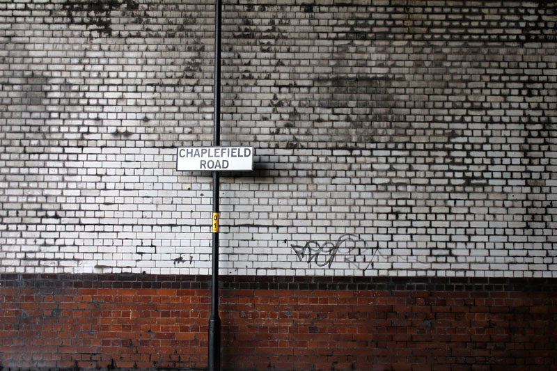
Today: January 31st 2013, the brick circle contains silver birches, wild brambles and much litter.

An unusual amount of discarded footwear.

Intervention: ‘Litter Shrine‘.


IMG_2988IMG_2984 IMG_2986IMG_2989 IMG_2990


IMG_2894

post

Ancoats Beach (Field Trip 3)

Buying a rake.

But arriving at the site and seeing there were three Environment Agency Vehicles there.

An animal hole.

The snow has melted.

Patterns in the sand.

Starting at the gated land that was once the Ancoats Nursery School…..

IMG_2943


And as Ancoats Nursery School was, on Palmerston Street, 1965.

ancoats-nursery-school-on-palmerston-street-facing-west-1965

Ancoats Nursery School on Palmerston Street, 1965. Courtesy J. Shaw

Due to the snowmelt the river Medlock is high today….

IMG_2944 IMG_2946The Environment Agency arrived to clear some of the rubbish….one of the men said that they would clear the sand away at some point. The barriers are to prevent trees and large rubbish entering the culverts in Manchester city centre. Once larger objects enter the culverts it is hard to remove them, and they can cause flooding.

IMG_2947 IMG_2948 IMG_2949What animal?

IMG_2950 IMG_2951 IMG_2952 IMG_2953 IMG_2955

post

Ancoats Beach (Field Trip 2)

Circling the Beach looking for concentric clues.

Melancholic trash.

Limekiln remains. Bricks.

Beswick poverty, poor store protected by monumental stones.

The invisible Ancoats Art Museum.

Manchester University Settlement and the Roundhouse.

IMG_2835 IMG_2839 IMG_2842wabi

loneliness / solitude

sabi

the suchness of everyday objects / the uniqueness of a thing in and of itself

aware

a feeling of nostalgia

yugen

mystery / hidden, ineffible dimension of reality

IMG_2845 IMG_2848Footpath up Lime Bank….

IMG_2850The birthday balloon has moved from the fence by the river and up the track…

IMG_2851 IMG_2852 IMG_2853Lime Bank, off Ashton Old Road….

IMG_2854‘Dark Island’ – all the way from the Orkney Brewery…

IMG_2855 IMG_2856I thought this mini-mart was probably closed down. But it is an ongoing open business. The council put the stone blocks around it after several car ram-raids on the shop….

IMG_2857 IMG_2858 IMG_2859I asked one of the guys in the shop if they knew where this stone came from, but they didn’t know. I was hoping it might have come from Ancoats Hall / Art Museum. Would love to find out.

IMG_2863Ardwick Youth Club demolition is progressing….

IMG_2867

IMG_2868This uprooted tree must have seeded  on top of a demolished building site – many bricks in the roots…

IMG_2870 IMG_2873 IMG_2874 IMG_2876 IMG_2879 IMG_2883Wild nature….

IMG_2885The site of Ancoats Hall and Ancoats Art Museum.

The Art Museum Committee was formed in December 1877, with the support and involvement of the Manchester Literary Club, the Manchester and Salford Sanitary Association, of which Thomas Horsfall had long been a member, the Manchester Statistical Society, local branches of the Sunday Society, the Ancoats Recreation Committee, and, from 1879, the Ruskin Society. Owens College and the Manchester Academy of Fine Arts were also involved, and support came from the Manchester Guardian in the shape of journalists W. T. Arnold and C. P. Scott. Despite a general air of moral support, the local and national depression was partly responsible for a lack of funding for Horsfall’s Art Museum project, and the delays this caused were compounded by difficult negotiations with Manchester Corporation. Although rooms were initially taken for the Art Museum at a new gallery in Queen’s Park, in north Manchester, relations between the Art Museum Committee and the Parks Committee broke down, and the former seat of the Mosley family at Ancoats Hall on the western bank of the River Medlock was not eventually secured until 1886, when it became the Museum’s home.

It eventually closed in 1953 when most of the collection was transferred to the Manchester Art Gallery (formerly the Royal Manchester Institution).

IMG_2888

ancoats_hall_chethams_library© Chetham’s Library, Manchester

(Note Bonnie Prince Charlie stayed at Ancoats Hall in 1745 – entertained by Oswald Mosley in the house which was then a Tudor design.)

In 1800 Mosely sold the Hall the local mill owner George murray, who demolished the hall and built a smaller Gothic structure in its place. That Hall was the one bought by T.C. Horsfall in 1876.

When the Hall became the Art Museum, William Morris helped Horsfall with wallpapers and textiles, which went up alongside engravings of Pre-Raphaelite works, and paintings by G.F.Watts and Turner.

ancoatshall 1964

Ancoats Hall, 20 Every Street,  1964 © Manchester Libraries

See blog on Thomas Horsfell and Manchester Art Museum

A lime kiln lane 1884Lime Kiln Lane, detail from 1880 OS for South Lancashire, courtsey of Digital Archives, http://www.digitalarchives.co.uk/

The events being the Man City matches mainly…..

IMG_2891This circular brick wall marks the spot of Christ Church, otherwise known as ‘The Round House’, opened in 1824. This was a chapel for the Bible Christian Movement. Members of the church were vegetarian and also political radicals. The first members BCM followed the lead of charismatic preacher William Cowherd who preached the revolutionary politics of Thomas Paine. Cowherd died before the chapel was established and his successor was Joseph Brotherton, who later became Salford’s first MP. Note that Brotherton’s wife, Martha, wrote the first vegetarian cookbook in 1812. The Church closed in 1880, moved into the hands of the Salvation Army and then to the Manchester University Settlement (which was also based at the nearby Ancoats Hall). In 1963 the Settlement moved out of Ancoats Hall and the building was subsequently demolished.

The chapel was sited on a burial ground, the gravestones of which are visible and arranged around the circle.

Through the silver birches can be seen the towers of All Soul’s Church further down Every Street.

IMG_2894The circle is sadly neglected and has become a tip for rubbish…..

IMG_2898 IMG_2903 IMG_2904 IMG_2906 IMG_2909 IMG_2913All Soul’s Church on Every Street. Pevsner describes it as “idiosyncratic Romanesque” in style. It closed in 1981.

‘Every’ comes from Yvery after Baron Yvery, whose daughter married into the landowning Mosley family.

IMG_2914 IMG_2917 IMG_2919 IMG_2923 IMG_2925 IMG_2926 IMG_2932The other side of Ardwick Youth Club demolition…

IMG_2938There was a school here on Palmerston Street – now demolished….

IMG_2939A brief return to the Round House site. “Dee Dee” (dog?) and glass table tops…

IMG_2942

post

Ancoats Beach (Field Trip 1)

23rd Jan 2013.

“Manchester’s got everything except a beach.”

lan Brown (former lead singer with The Stone Roses)

Sous les pavés, la plage. (Under the paving stones, the beach.)

Situationist International slogan; paris uprising 1968

“Beaches: Manchester’s undiscovered landscape”

Roger Bygott (Interactive Arts Practitioner)

This sullen sandy spot with snow. Dog and bird prints. Green bottle of QC. Embankment of bars and trash. A conjunction of questions.

Why is this place as it is? Why is is broken? What is the function of the ramp into the river? How did the sandbank form?

IMG_2676 IMG_2678 IMG_2679 IMG_2681 IMG_2682 IMG_2687 IMG_2688 IMG_2691 IMG_2692 IMG_2695


post

From Pillar to Post

This on site project involved taking photos in and around the Manchester Metropolitan University Car Park which is situated under the Mancunian Way, a motorway flyover.

The project developed in stages:

1) Taking the photographs.

2) Fly-postering the printed A3 photos onto the pillars of the Macunian Way within the Car Park.

3) Taking photographs of the original photographs in situ.

I was interested to engage with this space as it is a piece of modernist design from which it is possible to see mainly modernist buildings. Yet being a constricted space it was a challenge to frame the initial images. Can this space – generally regarded as somewhat ugly – become a site for an art exhibition? Is fly-postering a good way of sharing art? How does the intervention affect the space?

Not sure about the scale of these. Perhaps either  smaller images or really giant ones would be better. But I think the close-up photos of the photos on the pillars are effective – the mottled and dirty concrete providing a background for the images.

IMG_2641 IMG_2642 IMG_2643 IMG_2645 IMG_2646 IMG_2649 IMG_2650 IMG_2652 IMG_2656 IMG_2657 IMG_2659 IMG_2660 IMG_2665 IMG_2668 IMG_2669 IMG_2670 IMG_2671 IMG_2675

Text for one of the posters:

Pillar \Pil”lar\, n. [OE. pilerF. pilier, LL. pilare, pilarium,

pilarius, fr. L. pila a pillar. See Pile a heap.]

1. The general and popular term for a firm, upright,

insulated support for a superstructure; a pier, column, or

post; also, a column or shaft not supporting a

superstructure, as one erected for a monument or an

ornament.

Jacob set a pillar upon her grave.    –Gen. xxxv.

20.

The place . . . vast and proud, Supported by a

hundred pillars stood.                –Dryden.

2. Figuratively, that which resembles such a pillar in

appearance, character, or office; a supporter or mainstay;

as, the Pillars of Hercules; a pillar of the state. “You

are a well-deserving pillar.” –Shak.

By day a cloud, by night a pillar of fire. –Milton.

3. (R. C. Ch.) A portable ornamental column, formerly carried

before a cardinal, as emblematic of his support to the

church. [Obs.] –Skelton.

4. (Man.) The center of the volta, ring, or manege ground,

around which a horse turns.

From pillar to post, hither and thither; to and fro; from

one place or predicament to another; backward and forward.

[Colloq.]

Pillar saint. See Stylite.

Post \Post\, n. [AS., fr. L. postis, akin to ponere, positum, to

place. See Position, and cf. 4th Post.]

1. A piece of timber, metal, or other solid substance, fixed,

or to be fixed, firmly in an upright position, especially

when intended as a stay or support to something else; a

pillar; as, a hitching post; a fence post; the posts of a

house.

They shall take of the blood, and strike it on the

two side posts and on the upper doorpost of the

houses.                               –Ex. xii. 7.

Then by main force pulled up, and on his shoulders

bore, The gates of Azza, post and massy bar.

–Milton.

Unto his order he was a noble post.   –Chaucer.

Note: Post, in the sense of an upright timber or strut, is

used in composition, in such words as king-post,

queen-post, crown-post, gatepost, etc.

2. The doorpost of a victualer’s shop or inn, on which were

chalked the scores of customers; hence, a score; a debt.

[Obs.]

When God sends coin I will discharge your post. –S.

Rowlands.

From pillar to post. See under Pillar.

Knight of the post. See under Knight.

Post hanger (Mach.), a bearing for a revolving shaft,

adapted to be fastened to a post.

Post hole, a hole in the ground to set the foot of a post

in.

Post mill, a form of windmill so constructed that the whole

fabric rests on a vertical axis firmly fastened to the

ground, and capable of being turned as the direction of

the wind varies.

Source: Webster’s Revised Unabridged Dictionary (1913)

Pillar to Post Advert

post

Will Self: On Walking &Technology

In Confidence delves beneath the surface of some of the most creative spirits of the decade in probing interviews by critically acclaimed Radio 4 presenter and Sociology Professor Laurie Taylor.

post

Medlock Drift 20: Ancoats Bridge to New Viaduct Street

An odd mix of moods, mess, and ecology along this section of the River.

Ancoats Bridge….

IMG_2478Limekiln Lane:

CaCO3 + heat → CaO + CO2

CaO = Quicklime.

Because it is so readily made by heating limestone, lime must have been known from the earliest times, and all the early civilizations used it in building mortars and as a stabilizer in mud renders and floors. Knowledge of its value in agriculture is also ancient, but agricultural use only became widely possible when the use of coal made it cheap in the coalfields in the late 13th century, and an account of agricultural use was given in 1523.

IMG_2479 IMG_2480One of the best beaches in Manchester…

IMG_2481 IMG_2484 IMG_2486 IMG_2487Path up to Aden Close….

IMG_2488 IMG_2489 IMG_2490 IMG_2491 IMG_2492 IMG_2494 IMG_2495This was the Ardwick Youth Centre. Now being demolished….

IMG_2497

English Heritage’s Pastscape website notes that ” The Ardwick Lads’ and Mens’ Club, now the Ardwick Youth Centre, opened in 1897 and is believed to be Britain’s oldest purpose-built youth club still in use [and was until earlier in 2012]. Designed by architects W & G Higginbottom, the club, when opened, featured a large gymnasium with viewing gallery – where the 1933 All England Amateur Gymnastics Championships were held – three fives courts, a billiard room and two skittle alleys (later converted to shooting galleries). Boxing, cycling, cricket, swimming and badminton were also organised. At its peak between the two world wars, Ardwick was the Manchester area’s largest club, with 2,000 members.”

IMG_2499Views from the Palmerston Street bridge…..

IMG_2500 IMG_2502 IMG_2503Gurney Street Bridge….

IMG_2504 IMG_2506 IMG_2507 IMG_2508 IMG_2509 IMG_2510 IMG_2511Footbridge over to Purslow Close….

IMG_2512So much for the sign to St.Anne RC Primary….

IMG_2514Looking down over the Holt Town Bridge, marking the end of Ashton New Road and the start of Merrill St….

IMG_2516View up Merrill St….

IMG_2517And the new tramline extension out to Ashton-Under-Lyne is nearly complete…

IMG_2519

IMG_2522 IMG_2523Odd concrete dome….part of playground?

IMG_2525 IMG_2526The bridge at New Viaduct Street goes over both the River Medlock and the Ashton Canal.

IMG_2527 IMG_2528A heron in the Medlock – a good sign: heron = fish….

IMG_2530 IMG_2531New tramlines over the Medlock…..

IMG_2534The Gas Holder station is dominant in the local area….walking down Upper Cyrus Street…

IMG_2537Round the corner and down Upper Helena Street….rust, small businesses, corrugated iron, padlocked gates…

IMG_2538 IMG_2539This park had me a bit uneasy…there only one entrance to it and, until the works on the tramway are complete, there is no way out. It could be a delightful place with a bit of care.

IMG_2541The Ashton canal, frozen over….

IMG_2544Proximity to Man City Stadium…..

IMG_2545 IMG_2546 IMG_2547The Medlock flows under the Ashton Canal….

IMG_2551The Ashton Canal flows under the railway and over the Medlock….

IMG_2552 IMG_2553 IMG_2555 IMG_2556 IMG_2561 IMG_2563 IMG_2565 IMG_2566 IMG_2567 IMG_2569 IMG_2572Squirrel and broken glass…

IMG_2574The River Pub on Palmerston Road… (‘River’ i.e. Medlock)….

IMG_2575 IMG_2579

A good article on the demolition of Ardwick Lads Club and mentioning the River pub is here.

 On the 10th September 2012 an application for prior notification of proposed demolition was submitted on behalf of Manchester City Council to Manchester Planning, for the demolition off Ardwick Lads’ Club (Ardwick Youth Centre) of 100 Palmerston Street (M12 6PE), citing that there was “no use” for the building in respect to its historic place within the community as providing a refuge and sporting provision to the young of Ancoats.

All historical, architectural, build quality and potential use within existing and wider regeneration process were quickly dismissed. More details on the planning application can be read here: 100472/DEM/2012/N2

Whilst permission to demolish was “not required” (Decision Letter, 8th October 2012), it begs the questions, was it in the communities best interest to strip an area already critically lacking in its historical and architectural roots and importantly an area that already has little or no sporting or community provisions.

A last ditch attempt to save and spot list Ardwick Lads Club on historical and architectural grounds was dismissed by English Heritage and backed by theSecretary for Culture Media and Sport, with no attention paid to local significance or importance.

post

Medlock Soul Revival

Having walked most of the Medlock river in sections, I’m now thinking about the sorry state of the river. What has happened to the soul of the River? The relationship between it and the surrounding environment is pretty neglected. How many people appreciate the river in the city? – and it is the main river running through Manchester city centre (the Irwell is a Salford river). The amount of rubbish and fly-tipping I have witnessed is dreadful. I would argue that the quantity of rubbish dumped on a river bank is in inverse proportion to the degree of appreciation of the value of the river.

So I’m wondering about how to revive/retrieve the soul of the Medlock. Perhaps we need something more hands on…..

Hi vis jacket for Medlock Soul Retrieval project.

Hi vis jacket for Medlock Soul Revival project

Maybe a River Medlock rubbish ritual?

Art critic Suzi Gablik writes in an article in New Renaissance Magazine: 

Writing The Reenchantment of Art represented my own philosophical “break” with the paradigm of vision and the disembodied eye as the axiomatic basis for artistic practice.

For instance, I wrote at some length about an art project initiated by a friend of mine in Santa Fe, Dominique Mazeaud, which she calls “The Great Cleansing of the Rio Grande River”. For several years, armed with garbage bags donated by the city, Mazeaud and a few friends who sometimes accompanied her, would meet once a month and ritually clean garbage out of the river. Part of the work involves keeping a diary, entitled Riveries, in which she writes about her experiences. Briefly, here are some extracts:

November 19 My friend Margret drops me off at Delgado promptly at 9:00 am. Because of the snow I was not sure of the conditions I would find but did not doubt a second that I would put in my day. I find a stone warmed by the morning sun which makes a perfect site for my beginning prayer. Yes, I see what I am doing as a way of praying: Picking up a can/From the river/And then another/on and on/It’s like a devotee/Doing countless rosaries.

December 2 Why in all religions is water such a sacred symbol? How much longer is it going to take us to see the trouble of our waters? How many more dead fish floating on the Rhine River? How many kinds of toxic waste dumpings? When are we going to turn our malady of separateness around?

March 19 1 can’t get away from you river/In the middle of the night/I feel you on my back/In my throat, in my heart.

July 20 Two more huge bags I could hardly carry to the cans. I don’t count any more. I don’t announce my “art for the earth” in the papers either. All alone in the river, I pray and pick up, pick up and pray. Who can I really talk to about what I see?… I have also noticed that I stopped collecting the so-called treasures of the river. It was OK at the beginning, but today I feel it was buying into the present system of art that’s so much object-oriented. Is it because I am saying that what I am doing is art that I need to produce something?

Eventually, as the artist’s connection with the river deepens into that of friend and confidante, and even that of teacher, she reaches a point where her relationship with the river becomes even more important than her original ecological incentive to clean it. “For the first time last month,” she comments, my meditation directed me to go and be with the river and not do anything. The instructions were clear: “Don’t even take one garbage bag.” Her activity had subtly shifted, until it was no longer a systematic retrieving of everything in sight, but has become her own personal dialogue with the river. The river as a living being has something to say. “I have landed in a new landscape,” Mazeaud states, “where I discover the river is as true an artist as I am.”

Note: Ritual purification in world religions.

post

Medlock Drift 19: London Road to Ancoats Bridge

This area is the most chopped up, culverted and dark section of the River Medlock. As with most of the river in the city, the access and viewing points are hidden, hard to find and unwelcoming. To anthropomorphise a little, I would say the river here is depressed and unseen – even unwanted. The Bond Street and Baring Street industrial estates are seedy, grim sites. The river flows under many of the warehouses and businesses – silent and apologetic. For most of the walk I felt uneasy. This is an urban landscape of dodgy deals, broken bricks, muddy car parks, prostitution, and lurking danger.

Starting from Berry St and the back of the Macdonald Manchester Hotel (previously the BT building. Architect J L Hammond). Just visible, through the pillars,  is the Holloway Wall – a curious piece of brutalist modernism acting as a work of art and also a sound barrier for the old UMIST site.

IMG_2408Here is a video of Steve Millington from the Manchester Modernist Society talking about this area….

Victory House, later Telecom House, was completed in 1973 and designed by architect J L Hammond. The building was originally intended to be a hotel. At that time, tax relief was given to hotel builders, but shortly before it was due to open, the legislation changed, and the developer was forced to adapt it for office use.

“Graceful in its position, snaking down London Road, unusual window patterns, good detailing (especially on the rooftop plant blocks) and very elegantly and cleverly supported on slender supports this building is somewhat of a Cinderella. Ironically permission has recently been given to turn part of the building back into a hotel.” (Information and comments by Eddy Rhead)

IMG_2410 IMG_2411This vast warehouse seems to be currently unused….

IMG_2412The Medlock goes into the tunnel that takes it under the University of Manchester (old UMIST site) campus…..

IMG_2417 IMG_2420 IMG_2421This fragment of river is typical of how the river presents in this part of town. Emerging, curving and then disappearing under buildings….

IMG_2422Macdonald Hotel…..

IMG_2423The river stays north of the Mancunian Way. On the left is the Unversity Halls of Residence. Under the Mancunian Way is the skate park….(see Steve Millington video above)….

IMG_2425 IMG_2426 IMG_2427 IMG_2428Views from Baring street Bridge (presumably previously Boardman St Bridge according to sign).

IMG_2431 IMG_2432 IMG_2434The river goes under Fed Ex building….

IMG_2435 IMG_2436 IMG_2437 IMG_2439Baring street is where the taxis for Piccadilly Station queue…

IMG_2440 IMG_2441 IMG_2442 IMG_2443The only way to see the river as it emerges from under the Fed Ex site is to go onto the Klyn & Klyne car park. There was no-one around so I went on to the fire escape. From there the river is on a corner and visible emerging and disappearing again….at which point an officious man in a fork lift truck had a rant at me….

IMG_2444 IMG_2447The area around Bond street is particularly run down…

IMG_2449 IMG_2450The river runs somewhere under Temperance Street and Chapelfield Road…but hard to tell where exactly….

IMG_2451 IMG_2452 IMG_2453Spelling?

IMG_2454Finding the river again going under Fairfield Street. A nondescript bridge….

IMG_2456 IMG_2457 IMG_2458 IMG_2461Helmet Street, Aldow Industrial Park. The Medlock is behind the trees and security fence….

IMG_2462 IMG_2463 IMG_2464 IMG_2465 IMG_2466 IMG_2467View from Pin Mill Brow / Ancoats Bridge….

IMG_2468Ancoats Bridge marks the start of the Mancunian Way….

IMG_2469And on the other side of Ancoats Bridge is a promising piece of woodland with the path up to Holt Town and the Man. City Stadium…

IMG_2471 IMG_2472 IMG_2474 IMG_2476 IMG_2477

post

Medlock Drift 18: Clayton Vale to Alan Turing Bridge

13th January 2013.

Once a vast tip, Clayton Vale is now a well managed public amenity (and hence the least amount of rubbish on the whole river). Past industries include a print and dye works and Bradford Colliery. In around 1907 Manchester Corporation started to purchase buildings on the site for plans to use it as a tip for the ash cinders from Stuart St Power Station and as a municipal tip. Larger scale tipping started in the early 1920s at the western end of Clayton Vale, adjacent to Bank st Bridge, Clayton Vale Lane and the Manchester Corporation Sidings.

Waste disposal activities spread eastward down the valley and by 1966 the maps indicate that the entire area of Clayton Vale had either been used for tipping or was in current use as a landfill site. The landfill of the Vale took place prior to the Control of Pollution Act 1974 (which required that the disposal of all controlled wastes onto land be licensed); therefore the exact nature of the fill materials is not known. However, a review of documentation and historical maps held by MCC indicates that tipping commenced in Clayton Vale prior to 1909, with a small area of waste disposal located to the west of Clayton Vale House near Clayton Vale Bridge. It is understood that tipping ceased prior to 1974 and the historical maps indicate that the site was disused by 1981. The site was heavily polluted by industrial waste throughout the industrial revolution and even up to 1983. In 1982 Manchester City Council purchased the whole valley and began the reclamation of the site to turn it back into open space for the public.

IMG_2244Entrance gates to Medlock Vale…

IMG_2245 IMG_2247 IMG_2248 IMG_2249 IMG_2250 IMG_2252 IMG_2253 IMG_2254 IMG_2255Signs of moorings…

IMG_2256 IMG_2257 IMG_2258 IMG_2260 IMG_2262Work began in 1905 on the brick channel from the Iron Bridge at Clayton Vale to the bridge at Mill Street, now Alan Turing Way. Locally the river became known as the Red River because of the red bricks used to help with the flow of the river and to prevent flooding such as the famous one in 1872. On a 1909 map The River Medlock is shown as being culverted (A structure used to enclose the river to allow it to pass underneath a structure such as a road). By 1923 the River Medlock was fully canalised.

IMG_2263 IMG_2265 IMG_2266 IMG_2267 IMG_2268 IMG_2271 IMG_2273 IMG_2275 IMG_2277 IMG_2278 IMG_2282Tunnel under Bank Bridge Rd. The shape of the tunnel is unusual…

IMG_2285 IMG_2291 IMG_2292Industrial buildings at Philips Park on Riverpark Rd….

IMG_2293 IMG_2294 IMG_2296Philips Park Cemetery…..

IMG_2297The Jewish section of the cemetery is interesting. Only recently restored.

IMG_2298 IMG_2299 IMG_2301 IMG_2302This symbol on a Jewish headstone has got me curious. The snake eating its own tail or ‘ouroboros’ is an ancient mystical symbol, as far as I know not usually associated with Judaism.

IMG_2304 IMG_2308 IMG_2310 IMG_2312 IMG_2313 IMG_2314 IMG_2315 IMG_2318The exit of the river from the tunnel under Bank Bridge rd is not very accessible….brambles and scrubby bushes…..

IMG_2320Manchester Velodrome….

IMG_2321 IMG_2323Eithad / Man City Stadium behind the Bradford estate….

IMG_2326 IMG_2327 IMG_2328 IMG_2329 IMG_2330Here, as we reached Alan Turing Way, the river goes underground and under Holt Town, emerging from under New Viaduct St…..

IMG_2331 IMG_2333 IMG_2335 IMG_2336Mill Street Bridge is now Alan Turing Bridge. Alan Turing

IMG_2337 IMG_2338 IMG_2342 IMG_2343Interesting signage.

Turing’s homosexuality resulted in a criminal prosecution in 1952, when homosexual acts were still illegal in the United Kingdom. He accepted treatment with female hormones (chemical castration) as an alternative to prison. Turing died in 1954, just over two weeks before his 42nd birthday, from cyanide poisoning. An inquest determined that his death was suicide; his mother and some others believed his death was accidental. On 10 September 2009, following an Internet campaign, British Prime Minister Gordon Brown made an official public apology on behalf of the British government for “the appalling way he was treated”. As of May 2012, a private member’s bill was before the House of Lords which would grant Turing a statutory pardon if enacted. (Wikipedia)

IMG_2344 IMG_2347I found inner peace when I did my tax return…

IMG_2348 IMG_2349Western entrance to Philips Park Cemetery….

IMG_2353

Philips Park Cemetery

IMG_2354Ruined church…..

IMG_2356 IMG_2357 IMG_2362 IMG_2363Back towards the eastern end of Clayton Vale…

IMG_2365